![]()
United
Nations
AIRS precipitation (NASA)
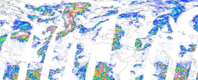
| Data provided by: | National Aeronautics and Space Administration (NASA) |
| Data accessibility: | export data, export map, visualization of data (e.g. web GIS or real time monitoring) |
| Link to the data: | |
| Requirements: | Registration is needed |
| Data type: | hazard specific data |
| Hazard: | Drought, Flood, Severe Storm |
| Disaster cycle phase: | Disaster Risk Management, Response, Recovery |
| Spatial coverage: | Global |
| Temporal coverage: | Archive, Near-real time |
| Technical Specifications: | |
| Costs: | free |
Provider
![]()