![]()
United
Nations
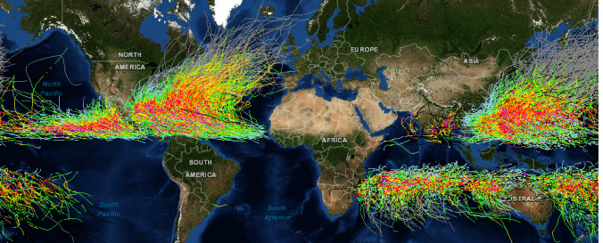
Storm Detection and Forecast (NOAA)
| Data provided by: | National Oceanic and Atmospheric Administration (NOAA) |
| Data accessibility: | export data, export map, statistical data (e.g. graphs) |
| Link to the data: | |
| Data type: | hazard specific data |
| Hazard: | Flood, Severe Storm |
| Disaster cycle phase: | Disaster Risk Management, Response, Recovery |
| Space-based Information: | SMS-2, GOES-1 to 13, Meteosat-2 to 9, MTSAT-1R, MTS-2, FY2-C/E, F8, F10 to 15, NOAA-5 to 18 |
| Satellites and Sensors: | GMS 2, 3, 4, 5 (VISSR), MetOp (GOME -2) |
| Spatial coverage: | Global |
| Spatial resolution: | 110574.29 |
| Temporal coverage: | Archive, Near-real time |
| Content dates: | 1842-2012 |
| Technical Specifications: | |
| Costs: | free |
| Contact: | NOAA Contact Form |
| Tutorials on the use of data: | Check Help on Historical Hurrican Tracks webpage |
| Restrictions/ Citation of the dataset: |
Provider
![]()