![]()
United
Nations
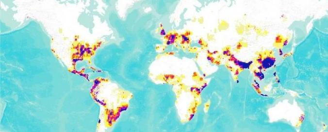
Global Flood Hazard Frequency and Distribution (CHRR)
| Data provided by: | Center for Hazards and Risk Research (CHRR) at Columbia University |
| Data accessibility: | export data, export map, visualization of data (e.g. web GIS or real time monitoring) |
| Data type: | hazard specific data |
| Hazard: | Flood |
| Disaster cycle phase: | Disaster Risk Management |
| Space-based Information: | MODIS, Landsat |
| Spatial coverage: | Global |
| Spatial resolution: | 250.00 |
| Temporal coverage: | Archive |
| Content dates: | 1985-2003 |
| Technical Specifications: | |
| Costs: | free |
| Contact: | hotspotsdata@ciesin.columbia.edu |
| Tutorials on the use of data: | Import data to a GIS platform, Use data to create Databasin webmap |
| Restrictions/ Citation of the dataset: | http://ciesin.columbia.edu/copyright.html |
Provider
![]()