![]()
United
Nations
Global Land Cover Facility (University of Maryland, NASA, GOFC-GOLD)
| Data provided by: | University of Maryland |
| Data accessibility: | export data, export map |
| Link to the data: | |
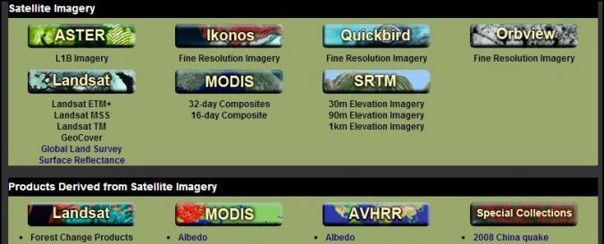
| File type: | GeoTIFF |
| Data type: | elevation, hazard specific data, land use, land cover data |
| Hazard: | Insect Infestation, Epidemic, Forest Fire, Drought, Volcanic Eruption, Earthquake, Mass Movement, Tsunami, Flood, Severe Storm, Extreme Temperature, Pollution |
| Disaster cycle phase: | Disaster Risk Management, Response, Recovery |
| Satellites and Sensors: | Terra (ASTER), Landsat 4, Landsat 1, Landsat 7, IKONOS, Aqua, Terra, QuickBird-2 (BGIS2000), SRTM (SIR-C), SRTM (X-SAR), OrbView-3 (OHRIS), OrbView-2 (SeaWiFS), GOES- 8-15 (IMAGER) |
| Spatial coverage: | Global |
| Spatial resolution: | Depends on satellite |
| Temporal coverage: | Archive |
| Costs: | free |
| Contact: | Global Land Cover Facility |
| Tutorials on the use of data: | Data and Technical Guide |
| Restrictions/ Citation of the dataset: | The only request in return is that the user acknowledge the GLCF as source of the dataset in any publication or presentation. |
Provider
![]()