GEO Business is the largest geospatial event in the UK designed for everyone involved in the gathering, storing, processing and delivery of geospatial information. Launched in 2014, the annual geospatial show has grown year on year and is now firmly established as the must-attend event in the industry attracting over 2500 people from more than 50 countries.
![]()
United
Nations
United Kingdom of Great Britain and Northern Ireland
country taxonomy block

The conference will be focused on Earth Observation science, technology and applications Into the Future. The programme will include exhibitions and poster sessions, a school conference (7th September), plus plenary and parallel sessions.
The NCEO, CEOI and RSPSoc are hosting the UK National Earth Observation Conference from 4-7 September at Birmingham University, with the topic “Earth Observation into the future”. The aim is to deliver a conference which attracts a significant gathering of the UK EO community across research, government and industry. We have involved the Earth Observation community in planning the content of the conference, and designed sessions to encompass all aspects of Earth Observation – science, technology, and applications.
moreENGAGE 2015 is a senior-level, invitation-only gathering bringing together key geospatial players and over 200 professionals from oil & gas, mining, environment, agriculture, global development organisations, defence & intelligence and location based services, for two days of discussion, engagement and learning.
Gain insight into the challenges and opportunities faced by senior-level executives from some of the world’s most eminent organisations across energy, mining, environment, agriculture, global development organisations, defence & intelligence and location based services.
Discuss your requirements with experts from the industry and influence future capabilities that can impact your organization’s performance.

The European Association of Remote Sensing Laboratories (EARSeL) organizes the annual Symposium, which aims to showcase current trends in remote sensing. Researchers, students, and professionals from Earth and environmental sciences who work with remotely sensed data are invited to Manchester Metropolitan University to attend the 43rd EARSeL Symposium in June 2024. The Symposium will consist of oral and poster sessions covering various workshop topics.
Workshops will be held on the topics of Agriculture, Coastal Zones, Land Use & Land Cover, and Earth Observation in the Global South. Themes covered in Special Sessions include Drylands, Earth Observation Education and Training, Geological Applications, Self-Supervised Techniques, Semantic and Explainable Analysis of Big Earth Observation Data, Thermal Remote Sensing, Unoccupied Aerial Systems, and Urban Systems & Resilient Cities.
The CEOI-ST has a vision to develop and strengthen UK expertise and capabilities in Earth observation (EO) instruments and works to position the UK to win leading roles in future international space programmes. The programme supports mainstream projects and smaller projects, both selected through Open Calls to the EO community.
However, although the technical drive has been to produce instruments for space, in many cases the resulting technologies have non-space applications. A number of sectors which could be potential beneficiaries of such technologies include healthcare, defence and security, analytical instrumentation, marine industries and environmental.
Objectives: The event is open to all interested parties and aims to:
- Highlight collaborative opportunities emanating from remote sensing technologies in space
- Outline the particular needs in Earth Observation for spin-in technologies
- Showcase a number of CEOI projects
The...
more
International Disaster Response Expo (IDR) tackles some of the most challenging threats to our nations whether man made or natural disasters. It is the most important event dedicated to humanitarian aid and disaster relief. With a highly focused audience uniting in London to drive innovation and help support development programmes and emergency aid, it is an unique opportunity to network, collaborate and build lasting relationship.
The IDR will host the Crisis Response Journal(CRJ)Theatre, which will look at the two most vital elements of society – people and where they live, examining the risks and threats that are inherent in urban areas, whether when working, living or during leisure activities. Add to this how we are increasingly becoming connected, both as individuals and through our infrastructure. How do we ensure the safety, security,...
more20th October 2014, 13:00 to 14:30, W007, Dept of Geography, Dr Ines V. Danao, Asian Social Institute
A seminar considering lessons to be drawn from the disaster risk reduction and management responses to Typhoon Haiyan in 2013; the 1990 Baguio Earthquake; 1991 Mount Pinatubo Eruption; and 2004 Mudfloods caused by Typhoon Winnie in the Philippines will be given by Dr Nancy Parreño from the Philippine Women’s University and Dr Inès V. Danao from the Asian Social Institute.
While both speakers have been involved in supporting victim survivors of these disasters, Dr Parreño will highlight community risk reduction and resilience building in the aftermath of such disasters and Dr Danao will emphasise governance issues, the creation of child friendly spaces in evacuation centres and critical incident stress debriefing.
This event was developed through links made with Professor Lena Dominelli at Durham in the aftermath of Hurricane Haiyan (known in the Philippines as...
more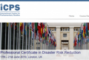
This course will provide those involved in disaster risk reduction with a clear understanding of the challenging dynamics of designing policies, mobilising resources and leveraging technology to reduce the risks and effects of disasters.
Interactive learning will support participants’ understanding of key issues in disaster risk reduction and strategic planning, such as monitoring risks, effective resourcing and coordinating fair and even delivery. By applying strategic planning tools throughout the training, participants will leave equipped to design and implement comprehensive plans that consider long-term trends and sustainability in disaster risk reduction planning that are supported by technology and the media.
A comprehensive analysis of the mechanisms behind strategic relief planning will be provided, with subjects to be discussed including:
- Proactive vs. reactive policies for risk reduction
- Resource allocation and mobilisation
- Identify...
![]()