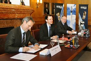
ESA and Eurockot today signed contracts for launching two ESA satellites: Sentinel-2A and Sentinel-3A will fly in 2013 on Rockot vehicles from the Plesetsk Cosmodrome in northern Russia for Europe’s GMES programme.
The contract signing by Matthias Oehm, Chief Executive Officer of Eurockot Launch Services GmbH, and Volker Liebig, Director of ESA’s Earth Observation Programmes, took place at the historic Chamber of Commerce of Bremen, Germany.
The Senator for Economics, Labour and Ports of the Free and Hanseatic City of Bremen, Martin Günthner, and the Chief Executive Officer of Astrium Space Transportation, Alain Charmeau, were also in attendance.
“With the launch of the first suite of Sentinels, a new era of Earth observation will start in Europe with the first worldwide operational monitoring system of environment and security,” noted Prof. Liebig.
Sentinel-2 and -3 are two of five Sentinel missions that ESA is…
more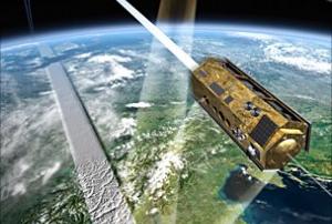


, processed by ESA, CC BY-SA 3.0 IGO.")